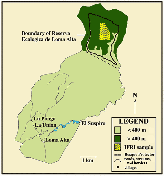
Fig. 2. Map of the Loma Alta watershed, Ecuador, showing location of settlements, boundaries of the community’s forest reserve, elevation, and the boundary of nationally designated protected forest. Loma Alta’s southern boundary borders the Valdivia river (called Rio California on some maps).